


I’m sitting in my uncle’s kitchen, raving about how rugged and unspoiled the scenery is across Canada’s portion of the Lake Superior shoreline, a few days after my daughter and I returned from our journey along Highway 17.
“Of course it is,” my uncle retorts. “No one goes there. It’s two days away from everywhere.”
On that last point, he’s not wrong. From the Toronto area, it takes a full day of driving, roughly seven and a half hours in all, to get to the lake’s eastern edge in Sault Ste. Marie. To drive from Ottawa, you’ll need almost nine hours. From the other direction, Thunder Bay is roughly eight hours away from Winnipeg. And once you reach either extreme, you’ll spend another eight hours in the car and cover 700 km getting to the other.
This vastness is what earned Lake Superior the Ojibwe name gichi-gami, the great sea. But it’s not a sea. It’s a lake – the largest freshwater lake in the world by surface area, in fact – and yet describing it as a sea is in many ways more apt: its frigid breezes, endless pebble beaches, sweeping currents, and wind-whipped waves are as reminiscent of the ocean as any point along Canada’s vast seashores. The only thing missing here is the smell of salt in the air.
But if my uncle is right that not a lot of people ever make it to the shores of Superior, then that’s a tragedy. It’s true that there aren’t a lot of golf courses and upscale resorts in this part of Ontario, and the water is too cold for swimming in most places, even late in the summer. If those are attributes you look for in a vacation, then you’ll be happier elsewhere.
What you’ll find here instead is multiple boundless landscapes that create a hikers’ paradise, small businesses such as artisan markets and bed and breakfasts, and authentic opportunities to connect with and understand the culture of the First Nations people who call this area home.
In other words, if expanses of nature and opportunities for isolation sound like bliss to you, then you really ought to visit before the secret gets out.
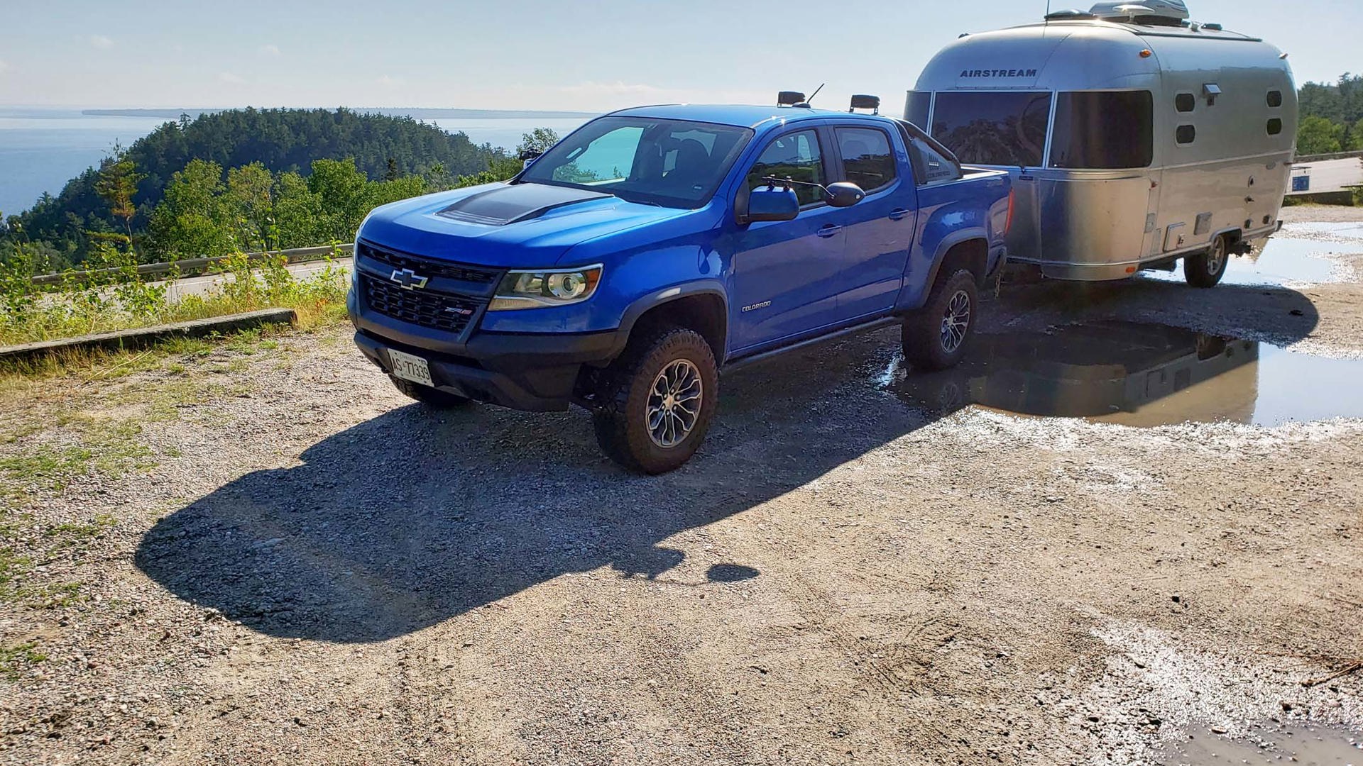
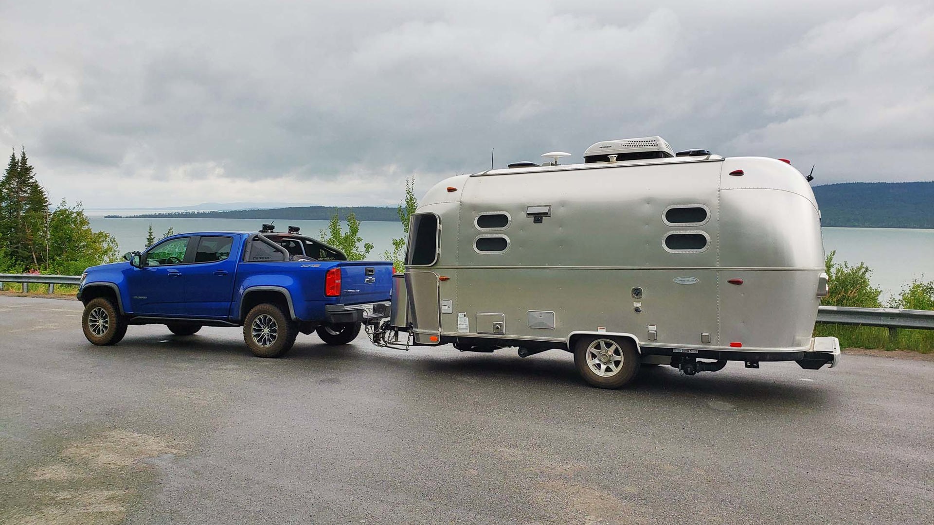
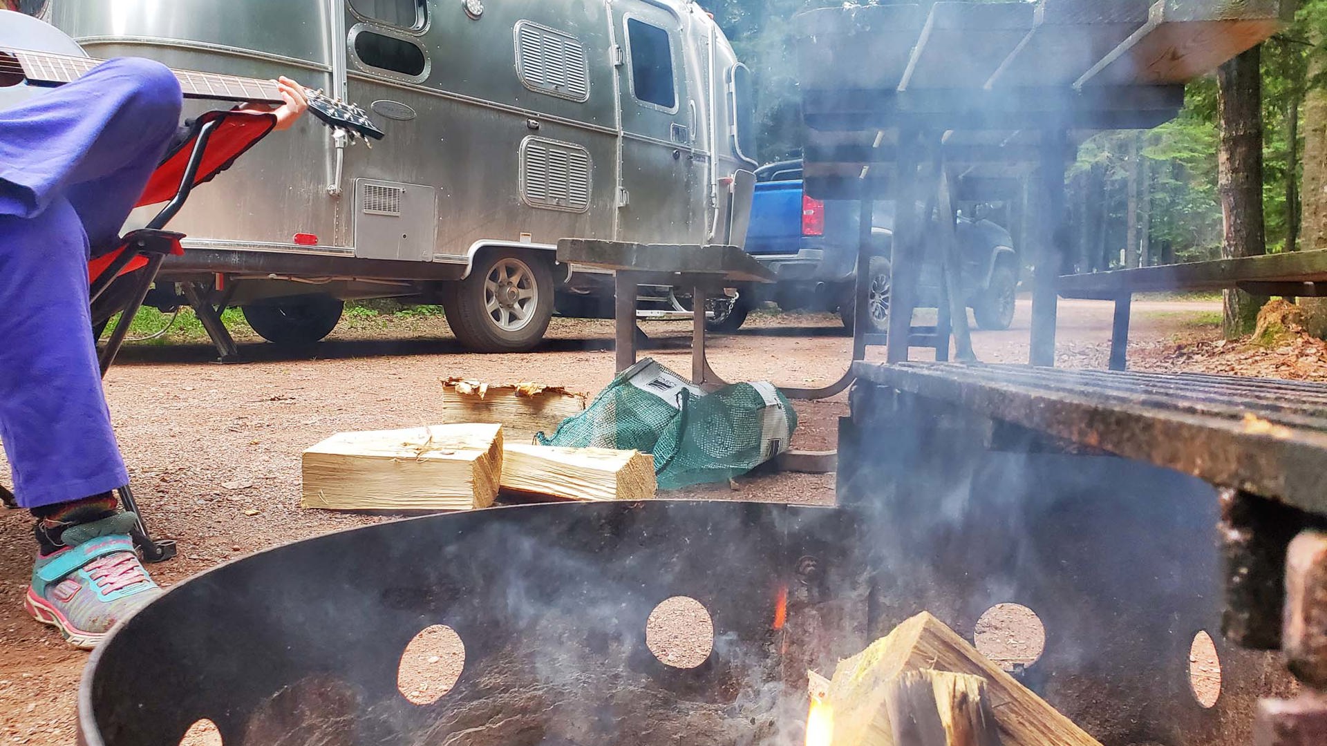
A note: these experiences are presented in order from the south since that’s how most road trippers would encounter them. However, this was the third leg of our road trip through Northern Ontario across Highway 11 and Manitoba in a 2019 Chevrolet Colorado ZR2 towing a 19-foot 2017 Airstream Flying Cloud that was supplied for evaluation by Can-AM RV in London, Ontario. My daughter and I therefore travelled in the opposite direction, starting from Thunder Bay.


Sault Ste. Marie: Gateway to Gichi-gami
The first point at which it’s possible to glimpse Lake Superior from Canadian soil is in the city of Sault Ste. Marie. This highly significant shipping thoroughfare has numerous other claims to fame, including being the birthplace of Canada’s first female astronaut, Dr. Roberta Bondar.
Those who regularly follow the road tripping adventures my daughter and I embark on will know that the Parks Canada Xplorers program regularly factors into our itineraries. There are two such places in the Sault Ste. Marie area – Fort St. Joseph National Historic Site, at the southern tip of nearby St. Joseph Island, and the Sault Ste. Marie Canal National Historic Site – both of which we covered in our Georgian Bay Circle Tour two summers ago.
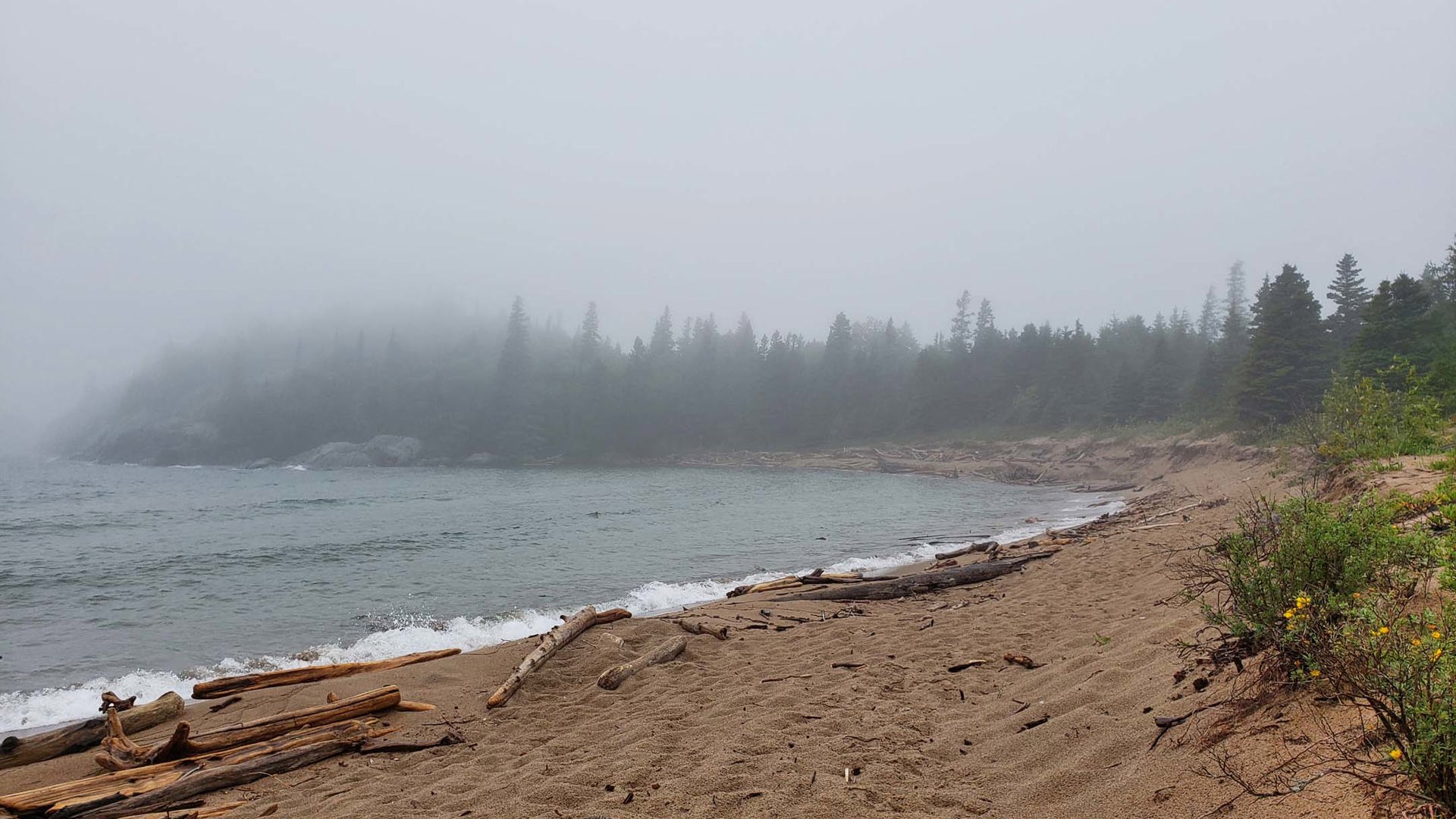
Pancake Bay Provincial Park: A Trail to an Ominous Legacy
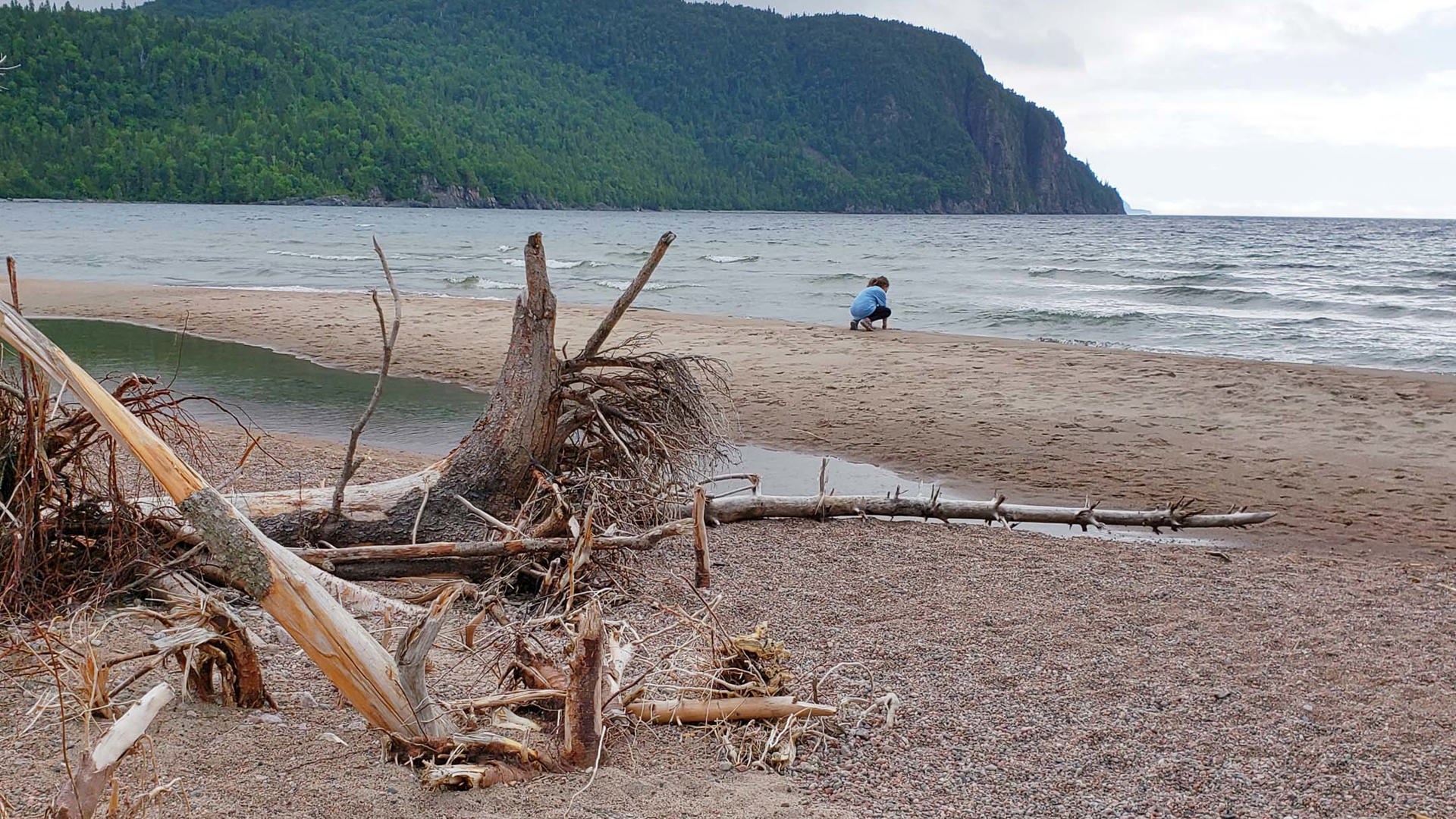
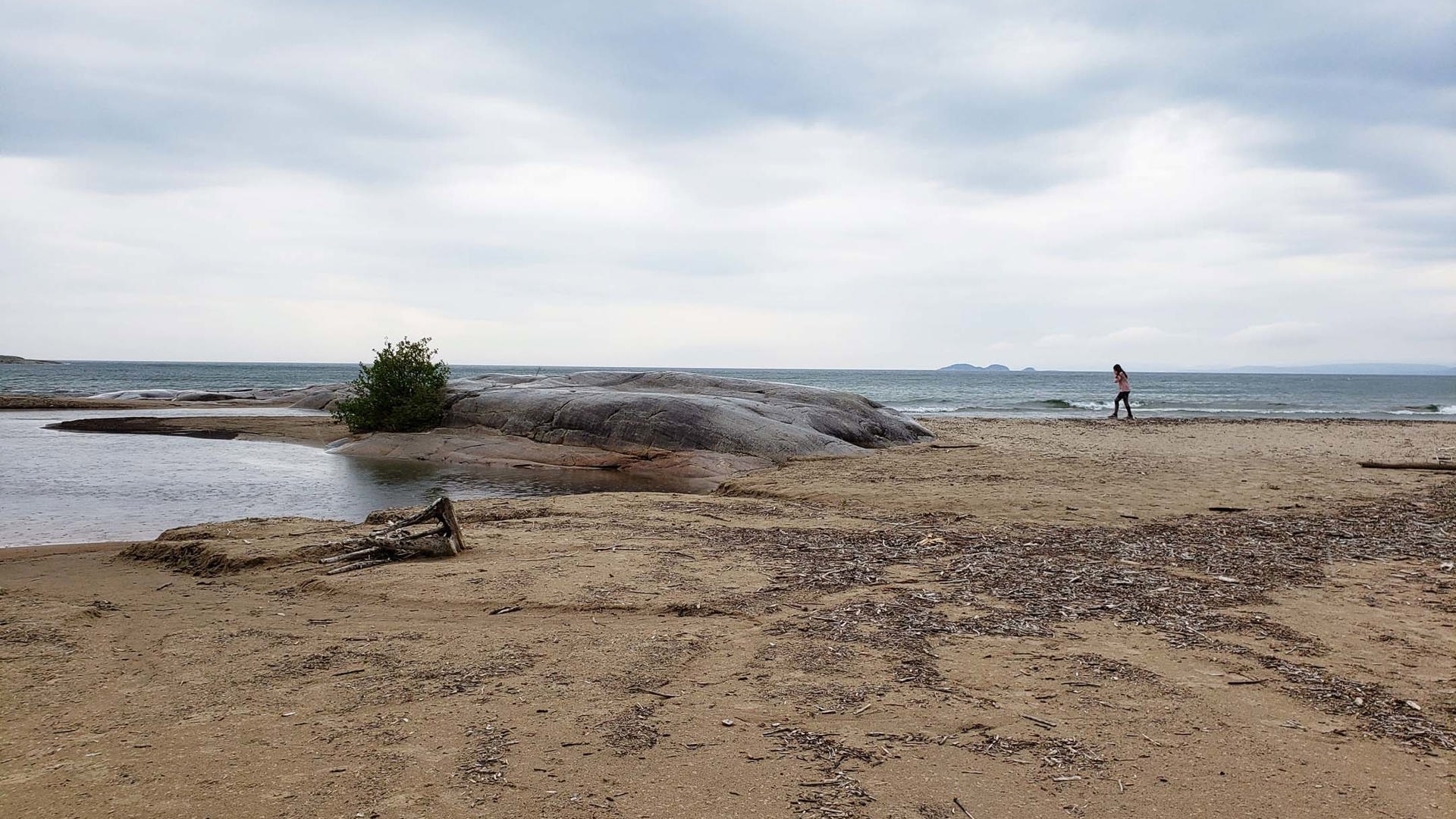
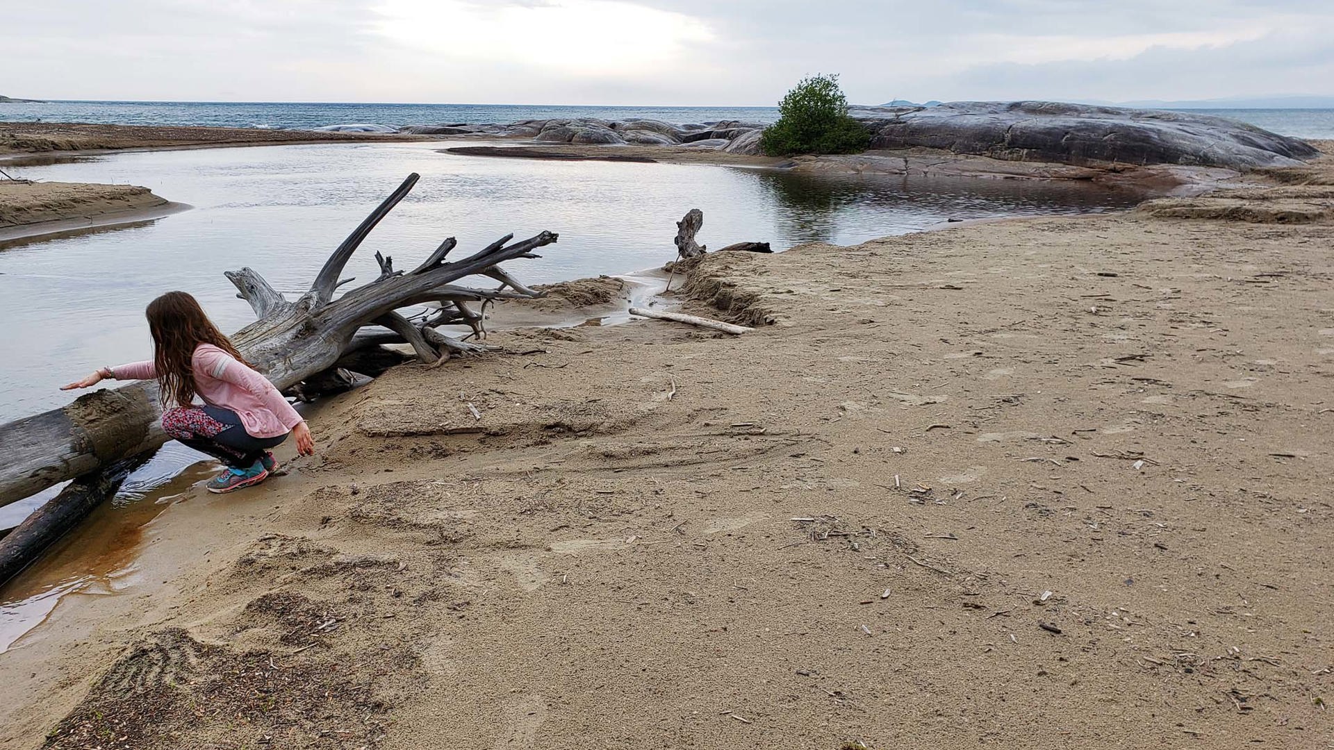
On its face, Pancake Bay is nice enough. It has hundreds of campsites set closely against a three-kilometre beach that looks like, if not for the pine trees, it was dropped here straight out of the Caribbean.
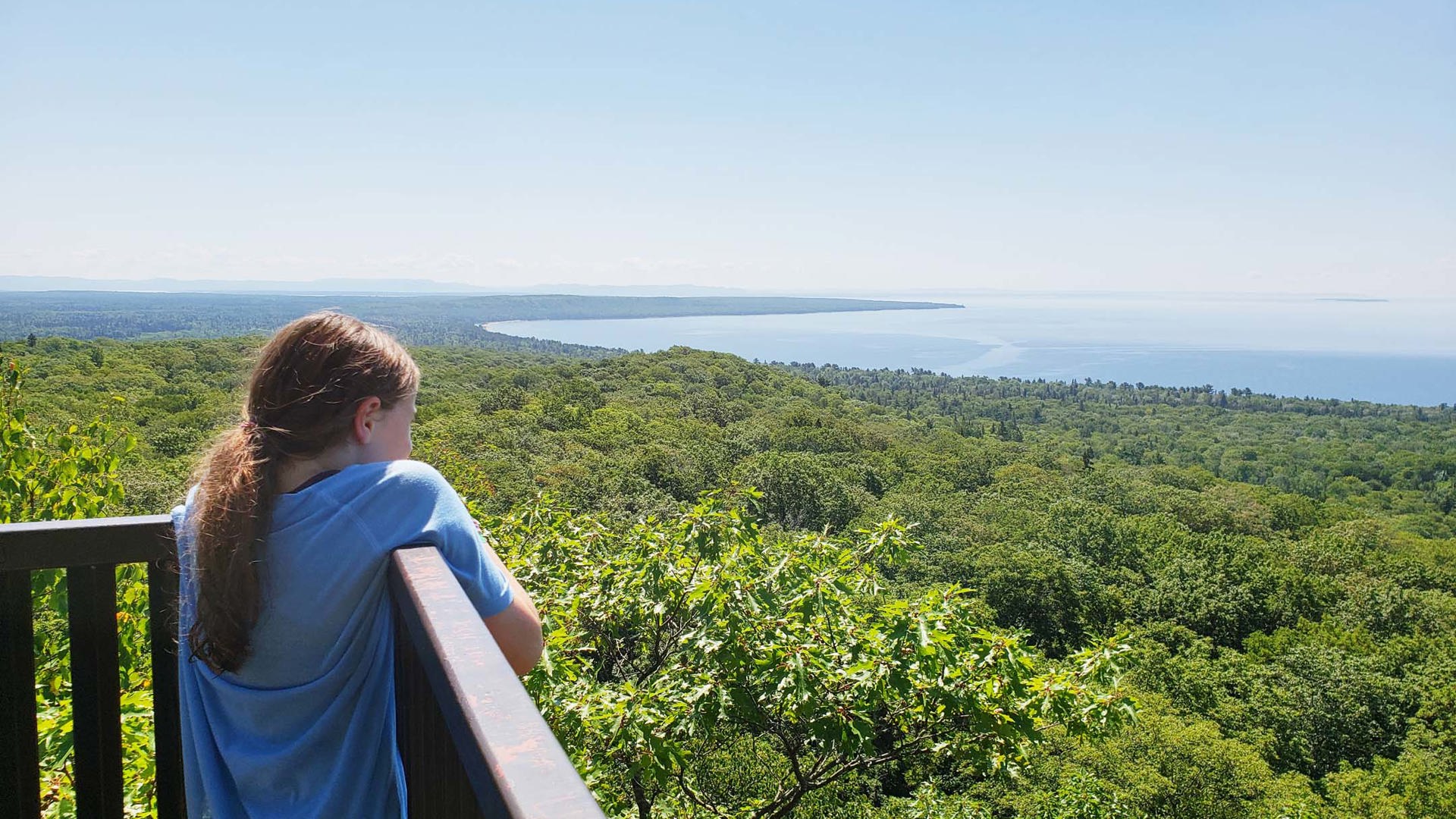
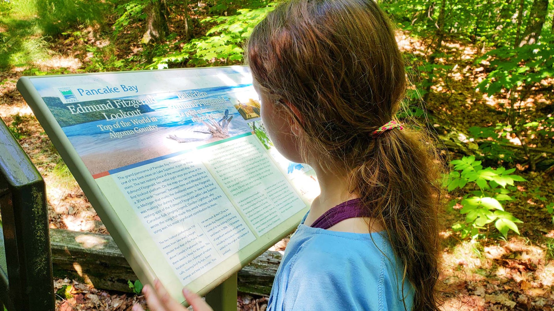
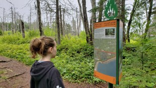
Follow Highway 17 for less than 2 km to the west, though, and you’ll find the trailhead for the Edmund Fitzgerald Lookout Trail, a much more poignant and fitting introduction – or farewell, in our case – to Superior’s simultaneous beauty and violence.
Traversing the entire 14 km trail can take up to seven hours, but a trip to the lookout platforms and back covers the important sections and is 7 km long, which takes two to three hours depending on your pace. The path is rugged but well-marked and not terribly difficult apart from tree roots and a few soggy sections. (Oh, and lots and lots of mosquitoes. Bring plenty of bug spray.)
The reward is a panoramic view over Whitefish Bay where it opens into Lake Superior. Just to the north of the entrance to the bay, the American freighter SS Edmund Fitzgerald sank on November 10, 1975, an event that spawned one of the most iconic Canadian folk songs ever written, Gordon Lightfoot’s Wreck of the Edmund Fitzgerald.
I’d played the song for my daughter at our campsite the night before to prepare her for what we were going to see. Once we reached the lookout platforms, she asked to hear it again. “I find the line where the cook says, ‘Fellas, it’s been good to know ya’ to be creepy,” she told me. I nodded, and then we looked thoughtfully out over the water for a while longer.
Superior, they said, never gives up her dead when the gales of November come early; the lake is beautiful beyond measure, but its waters hold the remnants of some very dark days. The lookouts offer a view over its vastness and its potential toll, setting you off on the remainder of your journey with an appropriate level of reverence.

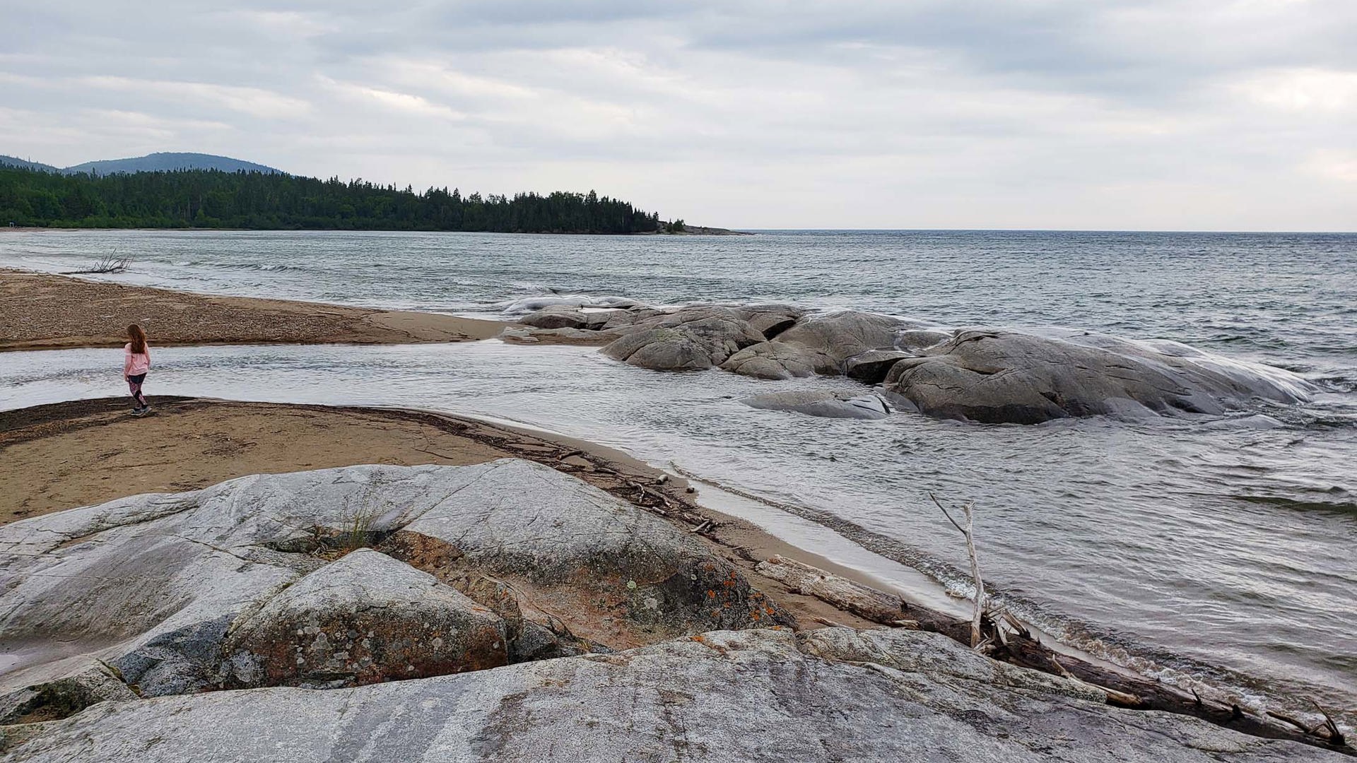
Lake Superior Provincial Park: An Iconic Canadian Drive
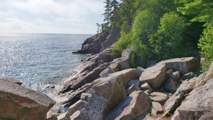
The drive along Highway 17 to and through Lake Superior Provincial Park is genuinely breathtaking, easily as picturesque as any of Canada’s better-known coastal routes. I have friends who live in Winnipeg who say they take Highway 11 when they need to drive to Toronto, especially if they’re towing, because it takes almost exactly the same amount of time but Highway 17 is more curvy and hilly and costs them more in gas. I’ve now driven both ways with the same truck-and-trailer combination, and can say confidently that I’d never in my life pass up an opportunity to drive this section of Highway 17 again, fuel bills be damned. We have an absolute embarrassment of riches in this country where scenery is concerned, and I can’t fathom not taking advantage of every available chance to appreciate it.
From the south, the first major stop you’ll encounter within park boundaries is Agawa Bay, where a visitor centre lets you pay your access fee and ask questions about the available activities and resources. (From the north, there’s no visitor centre; if you want to stop within the park, you’ll either need to bring cash to use the self-serve kiosks at the major stops, or you can risk doing what I did – because who carries cash anymore? – and leave a note on your dashboard promising to pay once you reach Agawa Bay.)
Agawa Bay is also home to the Agawa Rock Pictographs, the site of several centuries-old Indigenous paintings set on a granite cliff face. It’s a short hike to the pictographs down a trail that demands a bit of fitness and some sturdy shoes – it’s root- and rock-covered in places and likely gets slippery in bad weather. Once you’re there, one or two small images are visible from the end of the trail, but seeing more requires hanging off a series of chains to climb across sheer rock faces. The high water levels on the lake this past year made the whole thing look quite treacherous, so we decided we weren’t up for it. It’s unfortunate that the images are not more accessible, but I deeply respect that this place that the Ojibwe people consider sacred hasn’t been ripped apart and built upon just so that more people can have a look. Leaving it to be discovered only by those more intrepid seems like the correct approach.
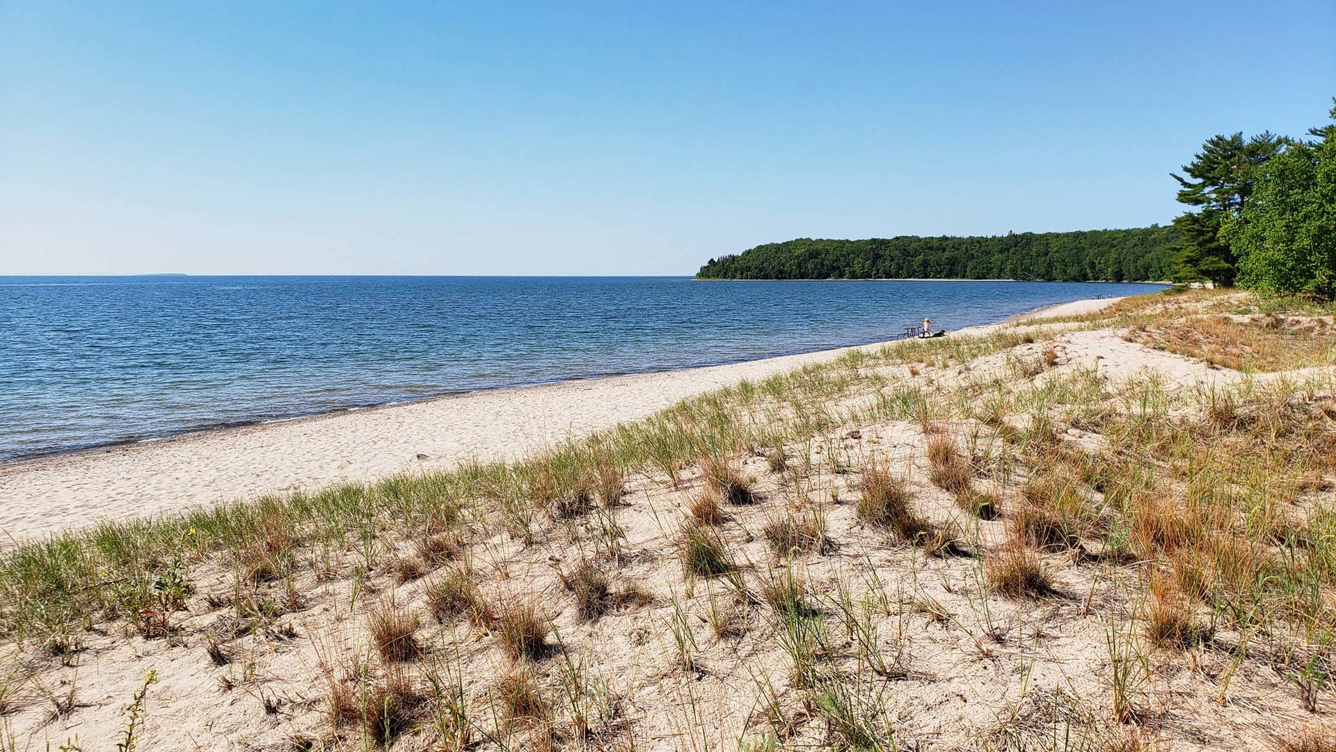
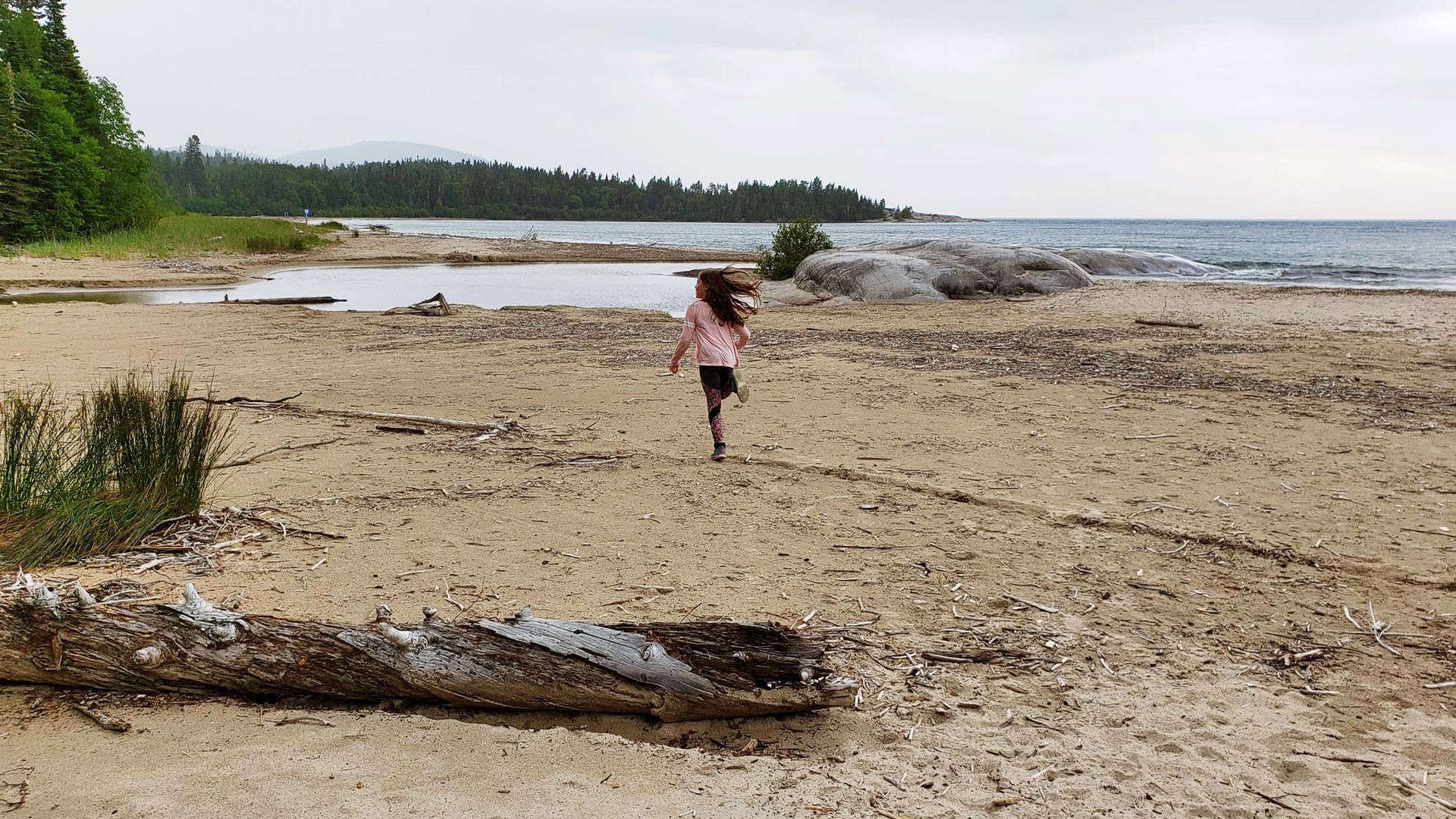
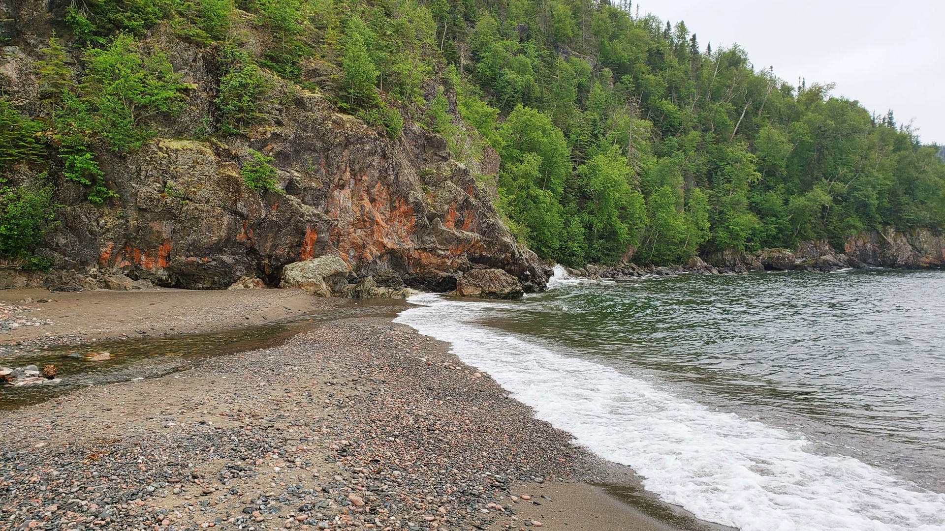
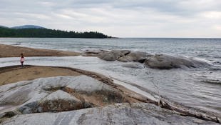
We also stopped at Old Woman Bay, named for the facial profile that can be seen in the most distant cliff face. Like many places in the park, it’s quiet, serene, undeveloped, and beautiful. A near-silent walk along a tree-lined beach is good for the soul.
Wawa and White River: Reminders of our Past
Past the north boundary of Lake Superior Provincial Park, the highway veers away from the lake and stays inland for almost 200 km. This would make for dull driving were it not for the towns with stories to tell along the way.
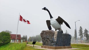
Wawa is known for its unusual name – the town so nice, they named it twice! – which translates to “wild goose” in Ojibwe. Once you know that, it suddenly makes sense that a giant Canada goose statue sits at the junction where Highway 101 meets the Trans-Canada Highway. Little Wawa, as Stompin’ Tom Connors called her in a song with the same name, overlooks the final section of the TCH that completed the route around Lake Superior when it opened in 1960.
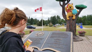
Further up the highway in White River, a statue of Winnie the Pooh, complete with his pot of hunny, sits in a tree on the side of the road. The real Winnie, an orphaned black bear cub, was purchased in White River in 1914 by Lt. Harry Colebourn, a British veterinarian. Colebourn bought her on the town’s train station platform from a trapper for $20, then transported her back to England where she became a favourite exhibit at the London Zoo. A young boy named Christopher Robin Milne took a liking to Winnie there, much to the delight of the boy’s father, A.A. Milne. He went on to author the book Winnie-the-Pooh and create one of the world’s most beloved children’s characters – and the whole thing started right here in northern Ontario.


Pukaskwa National Park: One of Canada’s Best-kept Natural Secrets
Much of the land that’s by-passed on that inland detour is designated as Pukaskwa National Park. If your final destination is the campground at Hattie Cove, you’ll need to drive all the way around the park, almost to Marathon, and then head south on Highway 627 through the Pic River First Nation to reach the main gate.
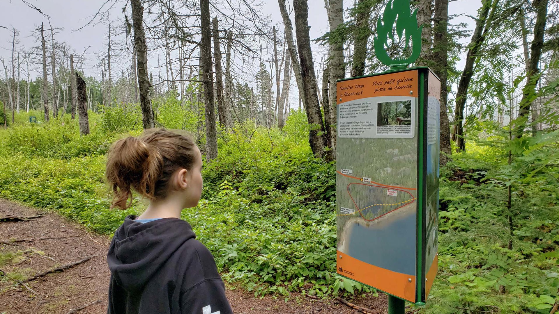
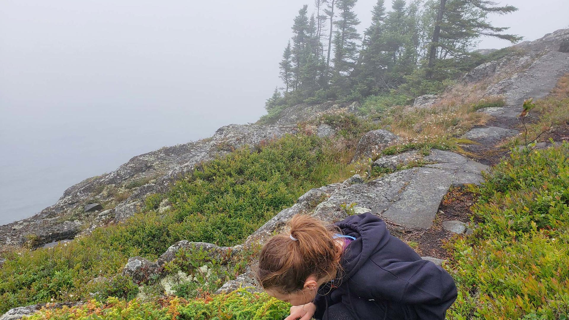
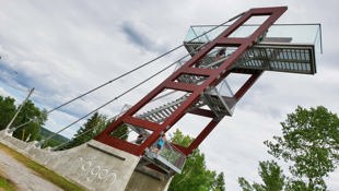
This land is absolute paradise for hikers and kayakers with multiple one to three-hour hikes found in easy reach of the Hattie Cove campground. Although there was a heavy fog on the morning we were there, we chose two quick hikes: the Fire Trail, a short trek from the visitor centre with interpretive panels that explain how a deliberately lit forest fire is helping conservation experts understand the role that fire plays in renewal; and the Manito Miikana trail, a pleasantly challenging two-hour hike to a pair of observation decks that offer views over Lake Superior. The Canadian Shield is on full display here in all its splendour, from craggy outcroppings to windswept pines and berry bushes clinging to the cliffsides. For those more adventurous, the White River Suspension Bridge trail is an eight- to nine-hour, 18 km hike to a bridge that hangs 23 metres above the Chigamiwinigum Falls. (We’re not quite at that level yet, but we hope to be soon.)
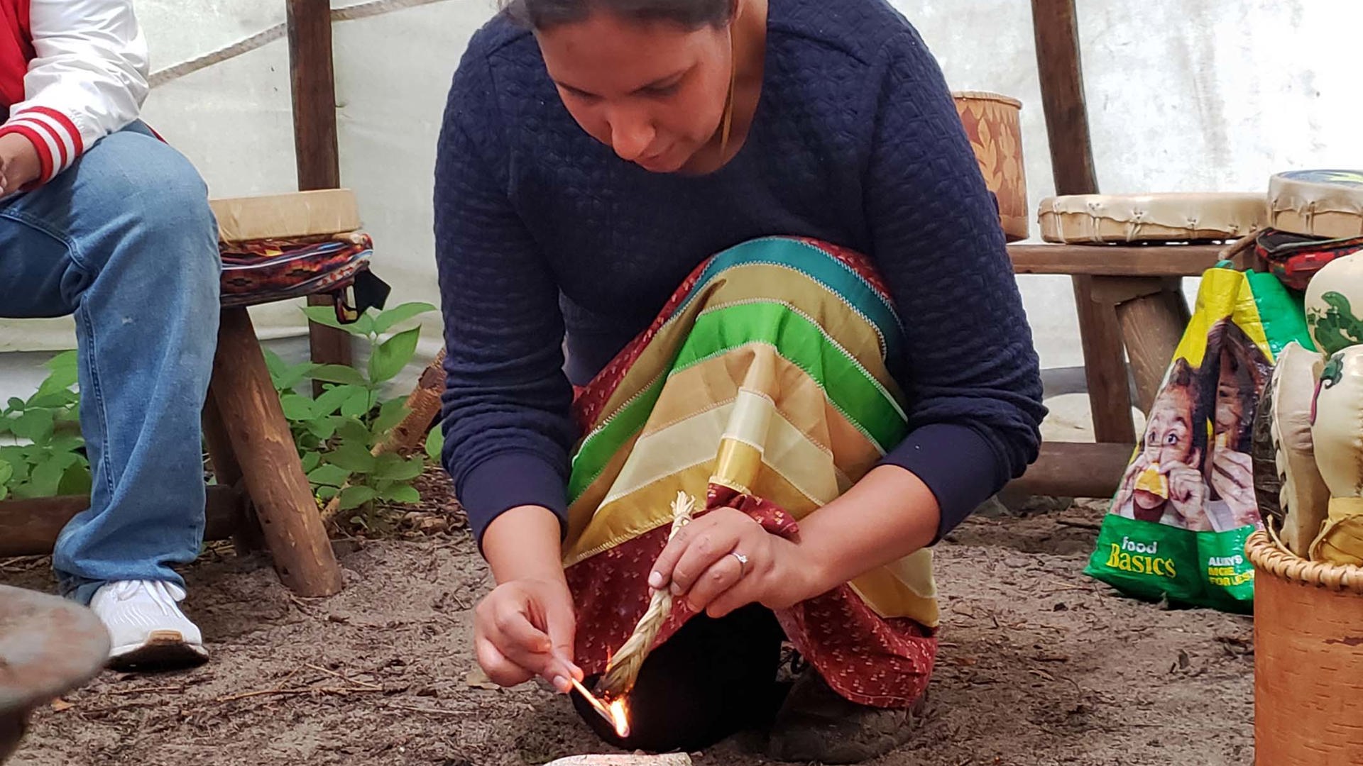
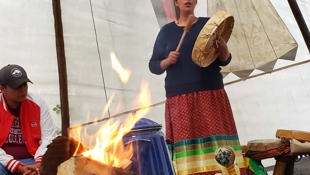
By far the most precious experience we had here was the Anishinaabe drum circle, led by a Pic River First Nation resident. She started with a smudging ceremony to cleanse the people and the instruments, and then we played along while listening to traditional songs themed after the Seven Grandfather Teachings. Afterward, she served a healing cedar tea made from boughs plucked with offering and gratitude from a nearby tree. This is a window into a culture that too few of us have made a sincere effort to truly understand. I feel privileged beyond words to have had my eyes opened to it.
Roughly 10,000 people visit Pukaskwa every summer – which is pronounced PUCK-uh-saw, by the way; don’t worry, this was news to me, too – and the Hattie Cove campground is so rarely full that the staff don’t even take reservations. It blows my mind that this beautiful, peaceful place with so much to teach us is protected as a national park for the benefit of all Canadians, and yet so few of us take advantage of it. Those who do find it quickly become aware that they’ve stumbled upon one of Canada’s best-kept natural secrets.
Neys Provincial Park and Lake Superior National Marine Conservation Area: Superior’s Finest
As you leave Pukaskwa National Park, you’re just over halfway between Sault Ste. Marie and Thunder Bay. The rest of the shoreline is dotted with small villages and areas of shoreline that are protected, either by provincial or federal government oversight.
Carrying on from the east, the first such space is Neys Provincial Park, less than 30 km west of Marathon. (And yes, the information centre on the Trans-Canada Highway outside Marathon is worth a stop. It’s full of arts and crafts created by genuinely local artisans, not shipped in from overseas.)
The beach at Prisoner Cove in Neys might be the most picturesque on all of Superior, and it’s said to be half-pleasant to swim in if conditions are right. Fine sand gives way to juts of rock, all of which looks over Superior’s expanse with the Barclay Islands visible in the distance. Neys has a fascinating history: between 1941 and 1946, the land here was used as a prisoner-of-war camp during World War II. Scant remnants of the POW camp can be found throughout the campground today.
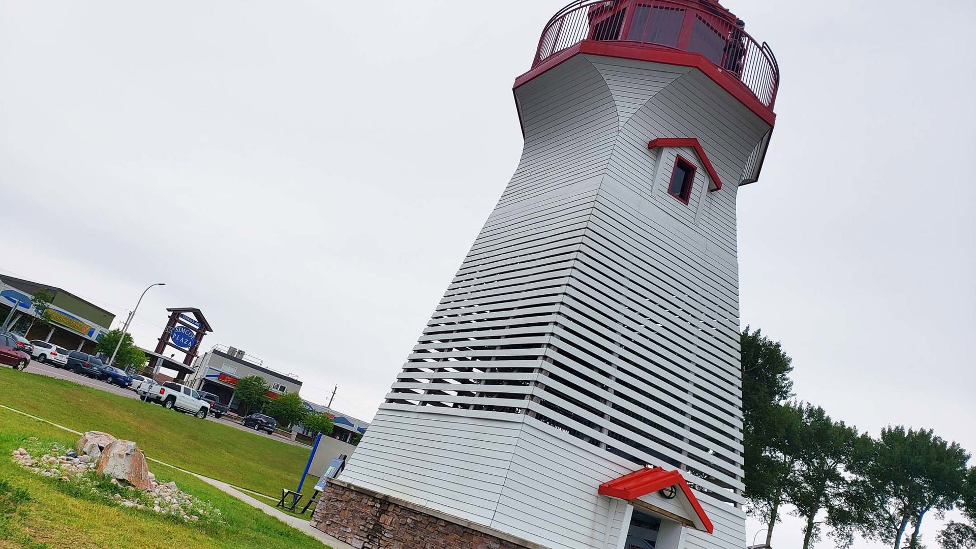
The next major settlement, just over 50 km to the west, is Terrace Bay. If you have children along, it’s a good plan to stop here to climb up the lighthouse and visit the information centre, where the Parks Canada Xplorers booklet for Lake Superior National Marine Conservation Area is available for pick-up.
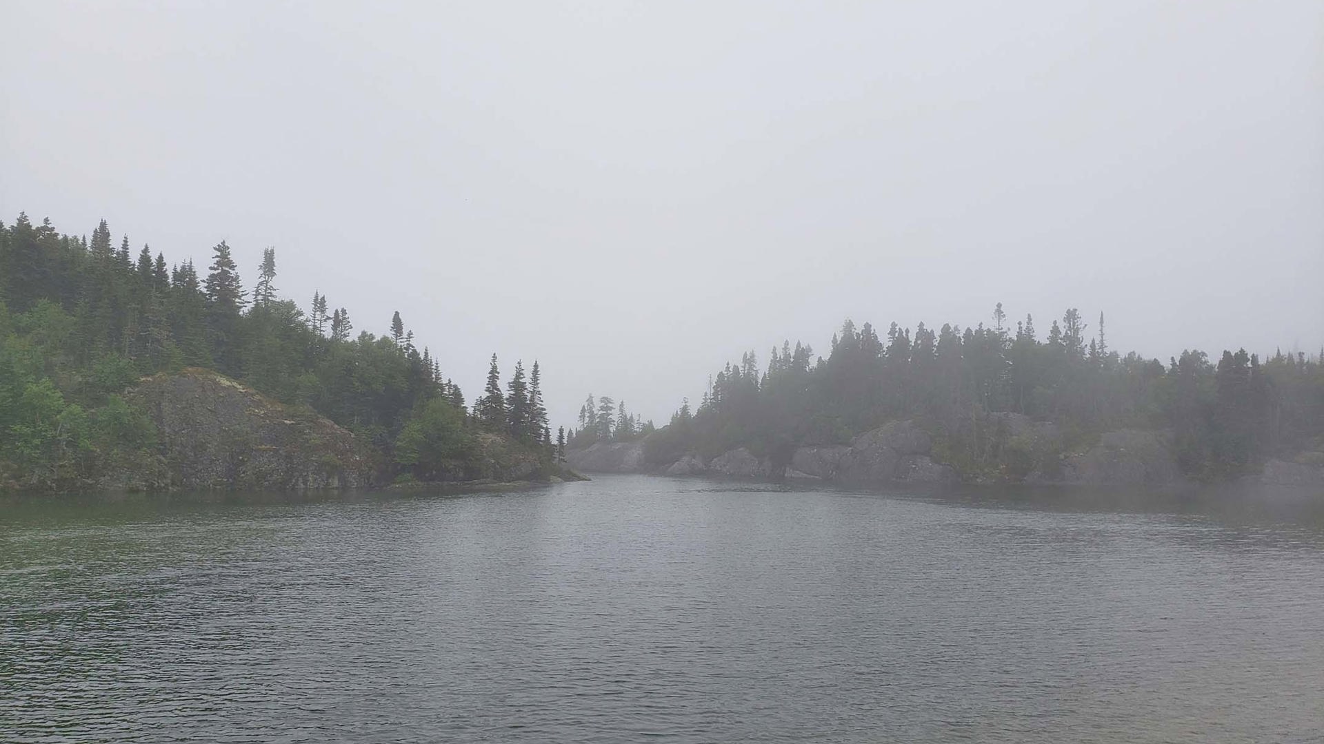
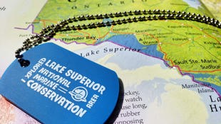
The idea of federally protected marine areas is relatively new, and this one even more so, having been established only four years ago. It was immediately the largest protected area of fresh water in the world, spanning from just east of Terrace Bay to include the waters around the Slate Islands, all the way to the western edge of the Sibley Peninsula. At both ends, its boundary runs south to the United States border.


The Xplorers booklets provide a great guide for points of interest along the way. We stopped to complete activities at Schreiber’s beautiful and accessible pebbled beach, walked among the colourful bed and breakfasts and a portion of the coastal trail in Rossport – we were meant to take a sea kayaking excursion from here to see some of the islands of the Schreiber Channel, but unfortunately the weather scuttled those plans – climbed the observation tower and followed the adventures of Paddle-to-the-Sea through a beautiful 12-station playground in Nipigon, and went critter dipping and enjoyed a submarine simulation at the Red Rock Marina Interpretive Centre. If you’re coming from the west, Red Rock Marina is a good place to pick up an Xplorers booklet. In either direction, plan to stop at the NMCA’s head office in Nipigon next to Paddle-to-the-Sea Park to pick up your tag; they don’t seem to be reliably available elsewhere.
Sleeping Giant Provincial Park and the Terry Fox Memorial: A Pair of Canadian Giants
Though its waters are protected under Lake Superior NMCA, the land of the Sibley Peninsula is largely under the stewardship of the province of Ontario as Sleeping Giant Provincial Park.
The peninsula’s cliffs, when viewed from the shores of Thunder Bay further west, are famous for taking the appearance of a man sleeping on his back. An Ojibwe legend names this giant as Nanabijou, the spirit of the deep-sea water, who was turned to stone after white men learned the location of the rich silver mine that lays at his feet. The mine at Silver Islet operated commercially for 16 years before being flooded by the waters of Lake Superior in 1884. Sleeping Giant is rife with hiking opportunities, from simple forest off-leash runs for dogs to challenging treks up the cliffs to the top of the giant himself.
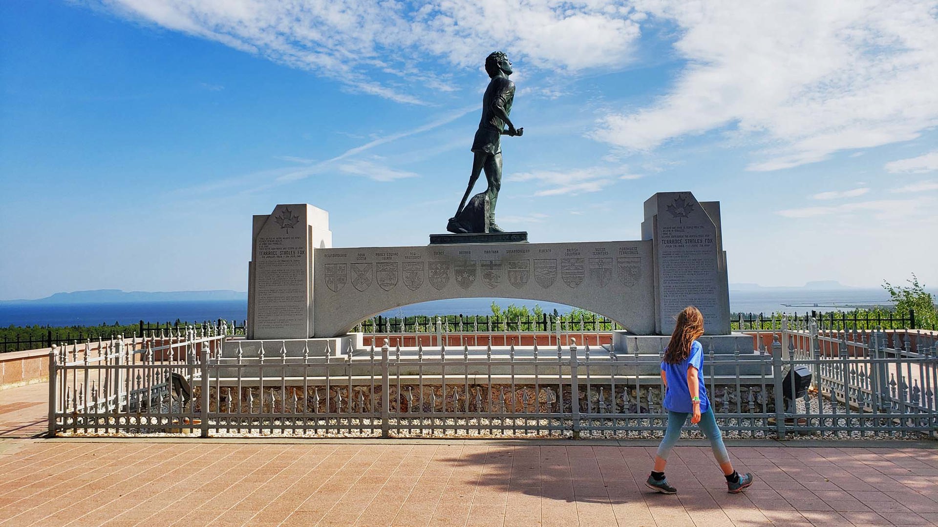
Just east of Thunder Bay, among the abundance of the area’s amethyst mines, the Terry Fox memorial overlooks the western reaches of Lake Superior from a hillside just off the Trans-Canada Highway less than two kilometres from where his Marathon of Hope ended at milepost 3,339. It’s a fitting place to honour him: the view Terry’s likeness has been given is among the best to be found anywhere in the country he inspired with his courage in the face of the cancer that ultimately took his young life.
Between the statue of Terry Fox and the giant that sleeps behind him, the enormity of this land’s gentle beauty, and the tenacity of the people who call it home, are on permanent display along gichi-gami’s glorious shores.

You may also like